
Clashmore topographic map
Interactive map
Click on the map to display elevation.
About this map
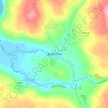
Name: Clashmore topographic map, elevation, terrain.
Location: Clashmore, County Waterford, Munster, P36 VK31, Ireland (51.98890 -7.83932 52.02890 -7.79932)
Average elevation: 49 m
Minimum elevation: -4 m
Maximum elevation: 124 m
Ireland trails, hiking, mountain biking, running and outdoor activities