
Mara topographic map
Interactive map
Click on the map to display elevation.
About this map
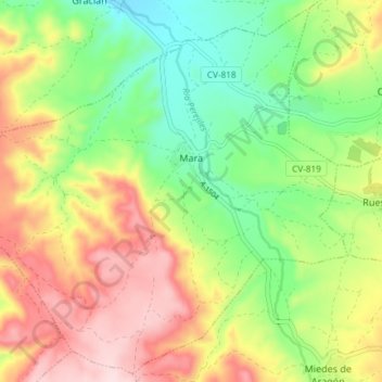
Name: Mara topographic map, elevation, terrain.
Location: Mara, Comunidad de Calatayud, Zaragoza, Aragon, Spain (41.25762 -1.56165 41.31081 -1.48776)
Average elevation: 773 m
Minimum elevation: 645 m
Maximum elevation: 931 m
Other topographic maps
Click on a map to view its topography, its elevation and its terrain.
Calatayud
Spain > Aragon > Comunidad de Calatayud
Calatayud, Comunidad de Calatayud, Zaragoza, Aragon, 50300, Spain
Average elevation: 693 m