
Hart topographic map
Interactive map
Click on the map to display elevation.
About this map
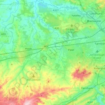
Name: Hart topographic map, elevation, terrain.
Location: Hart, Hampshire, South East, England, United Kingdom (51.18601 -1.00230 51.36632 -0.76292)
Average elevation: 90 m
Minimum elevation: 42 m
Maximum elevation: 226 m
Other topographic maps
Click on a map to view its topography, its elevation and its terrain.
Blackwater and Hawley
United Kingdom > England > Hart
Blackwater and Hawley, Hart, Hampshire, South East, England, United Kingdom
Average elevation: 75 m