
Burnfoot topographic map
Interactive map
Click on the map to display elevation.
About this map
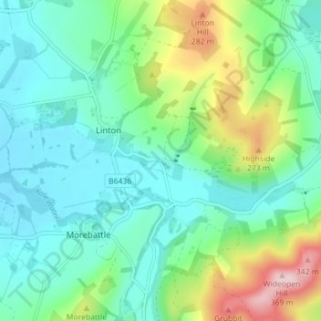
Name: Burnfoot topographic map, elevation, terrain.
Location: Burnfoot, Scottish Borders, Scotland, TD5 8AG, United Kingdom (55.50658 -2.36772 55.54658 -2.32772)
Average elevation: 146 m
Minimum elevation: 71 m
Maximum elevation: 359 m