
Bashkia Durrës topographic map
Interactive map
Click on the map to display elevation.
About this map
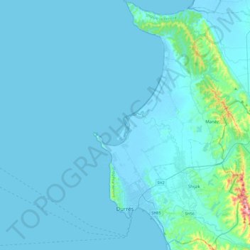
Name: Bashkia Durrës topographic map, elevation, terrain.
Location: Bashkia Durrës, Durrës County, Northern Albania, Albania (41.24983 19.39139 41.58789 19.62494)
Average elevation: 24 m
Minimum elevation: -6 m
Maximum elevation: 465 m
Other topographic maps
Click on a map to view its topography, its elevation and its terrain.