
Ogre topographic map
Interactive map
Click on the map to display elevation.
About this map
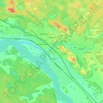
Name: Ogre topographic map, elevation, terrain.
Location: Ogre, Ogres novads, Zemgale, LV-5001, Latvia (56.78949 24.55572 56.83242 24.66548)
Average elevation: 29 m
Minimum elevation: 8 m
Maximum elevation: 65 m