
Norway topographic map
Interactive map
Click on the map to display elevation.
About this map
Name: Norway topographic map, elevation, terrain.
Location: Norway (-54.65400 -9.68463 81.02802 34.68891)
Average elevation: 294 m
Minimum elevation: -30 m
Maximum elevation: 7,179 m
Little has been found dating from the early Iron Age (the last 500 years BC). The dead were cremated, and their graves contain few burial goods. During the first four centuries AD, the people of Norway were in contact with Roman-occupied Gaul. About 70 Roman bronze cauldrons, often used as burial urns, have been found. Contact with the civilised countries farther south brought a knowledge of runes; the oldest known Norwegian runic inscription dates from the third century. At this time, the amount of settled area in the country increased, a development that can be traced by coordinated studies of topography, archaeology, and place-names. The oldest root names, such as nes, vik, and bø ("cape," "bay," and "farm"), are of great antiquity, dating perhaps from the Bronze Age, whereas the earliest of the groups of compound names with the suffixes vin ("meadow") or heim ("settlement"), as in Bjǫrgvin (Bergen) or Sǿheim (Seim), usually date from the first century AD.
Other topographic maps
Click on a map to view its topography, its elevation and its terrain.
Ireland
Ireland
Average elevation: 44 m
Chasiv Yar
Chasiv Yar, Chasiv Yar urban hromada, Bakhmut Raion, Donetsk Oblast, 84551-84556, Ukraine
Average elevation: 213 m
Monterey County
Monterey County, California, United States
Average elevation: 282 m
Taiwan
Taiwan > Taiwan Province > Xinyi Township
Taiwan, Xinyi Township, Nantou County, Taiwan Province, Taiwan
Average elevation: 196 m
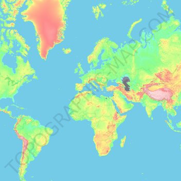
Europe
Europe
Average elevation: 223 m
Valencia
Spain > Valencian Community > Comarca de València
Valencia, Comarca de València, Valencia, Valencian Community, Spain
Average elevation: 37 m
Croatia
Croatia
Average elevation: 323 m
Cork
Ireland > County Cork > Cork
Cork, County Cork, Munster, T12 T997, Ireland
Average elevation: 94 m
Victorville
United States > California > San Bernardino County
Victorville, San Bernardino County, California, United States
Average elevation: 920 m
Madagascar
Madagascar
Average elevation: 139 m
Ban Phayom
Thailand > Phayom Subdistrict Administrative Organization > Phayom Subdistrict
Ban Phayom, Phayom Subdistrict, Phayom Subdistrict Administrative Organization, Wang Noi District, Phra Nakhon Si Ayutthaya Province, 13170, Thailand
Average elevation: 4 m
Port Saint Lucie
United States > Florida > Saint Lucie County
Port Saint Lucie, Saint Lucie County, Florida, United States
Average elevation: 7 m
Oakton
United States > Virginia > Fairfax County
Oakton, Fairfax County, Virginia, 20030, United States
Average elevation: 114 m
San Bernardino County
San Bernardino County, California, United States
Average elevation: 763 m
Bangladesh
Bangladesh
Average elevation: 161 m
Saint Petersburg
United States > Florida > Pinellas County
Saint Petersburg, Pinellas County, Florida, United States
Average elevation: 3 m
El Salvador
El Salvador
Average elevation: 484 m
Czechia
Czechia
Average elevation: 369 m
El Dorado County
El Dorado County, California, United States
Average elevation: 1,286 m
Mansfield
Canada > Ontario > Dufferin County > Mulmur
Mansfield, Mulmur, Dufferin County, Central Ontario, Ontario, L0N 1M0, Canada
Average elevation: 318 m
Sligo
Sligo, Sligo Municipal Borough District, County Sligo, Connacht, Ireland
Average elevation: 21 m
Ancient Olympia
Greece > Peloponnese, Western Greece and the Ionian > Elis Regional Unit
Ancient Olympia, Municipality of Ancient Olympia, Elis Regional Unit, Western Greece, Peloponnese, Western Greece and the Ionian, 270 65, Greece
Average elevation: 99 m
Navvy Jack Point Park
Canada > British Columbia > Metro Vancouver Regional District > West Vancouver
Navvy Jack Point Park, Ambleside, West Vancouver, Metro Vancouver Regional District, British Columbia, Canada
Average elevation: 23 m
Kazan
Russia > Tatarstan > городской округ Казань
Kazan, городской округ Казань, Tatarstan, Volga Federal District, Russia
Average elevation: 104 m
Sochi
Russia > Krasnodar Krai > Resort Town of Sochi (municipal formation)
Sochi, Resort Town of Sochi (municipal formation), Krasnodar Krai, Southern Federal District, Russia
Average elevation: 515 m
Tooele County
United States of America > Utah
Tooele County, Utah, United States of America
Average elevation: 1,462 m
Lausanne
Switzerland > Vaud > District de Lausanne
Lausanne, District de Lausanne, Vaud, Switzerland
Average elevation: 621 m
Lusikisiki
South Africa > Eastern Cape > O.R. Tambo District Municipality > Ingquza Hill Local Municipality
Lusikisiki, Ingquza Hill Local Municipality, O.R. Tambo District Municipality, Eastern Cape, South Africa
Average elevation: 563 m
Springfield
United States > Virginia > Fairfax County > Springfield
Springfield, Fairfax County, Virginia, 22150, United States
Average elevation: 68 m
Lorton
United States > Virginia > Fairfax County
Lorton, Fairfax County, Virginia, United States
Average elevation: 41 m
Tring
United Kingdom > England > Hertfordshire > Dacorum
Tring, Dacorum, Hertfordshire, England, United Kingdom
Average elevation: 168 m
Delaware County
Delaware County, Indiana, United States
Average elevation: 288 m
Chino
United States > California > San Bernardino County
Chino, San Bernardino County, California, United States
Average elevation: 239 m
Mulmur
Canada > Ontario > Dufferin County
Mulmur, Dufferin County, Central Ontario, Ontario, Canada
Average elevation: 386 m
Milton
Canada > Ontario > Halton Region > Milton
Milton, Halton Hills, Halton Region, Golden Horseshoe, Ontario, Canada
Average elevation: 243 m
Ougney
France > Bourgogne – Franche-Comté > Jura
Ougney, Dole, Jura, Bourgogne – Franche-Comté, Metropolitan France, 39350, France
Average elevation: 248 m