
Corduff topographic map
Interactive map
Click on the map to display elevation.
About this map
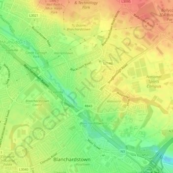
Name: Corduff topographic map, elevation, terrain.
Average elevation: 66 m
Minimum elevation: 35 m
Maximum elevation: 90 m
Other topographic maps
Click on a map to view its topography, its elevation and its terrain.
Scribblestown
Scribblestown, Blanchardstown-Abbotstown ED, Dublin 15, Fingal, County Dublin, Leinster, Ireland
Average elevation: 57 m