
Tetulia topographic map
Interactive map
Click on the map to display elevation.
About this map
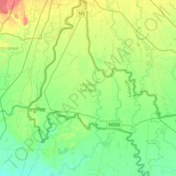
Name: Tetulia topographic map, elevation, terrain.
Location: Tetulia, Panchagarh District, Rangpur Division, Bangladesh (26.40337 88.33077 26.63825 88.53666)
Average elevation: 90 m
Minimum elevation: 70 m
Maximum elevation: 134 m
Other topographic maps
Click on a map to view its topography, its elevation and its terrain.