
Shelby County topographic map
Interactive map
Click on the map to display elevation.
About this map
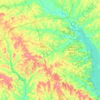
Name: Shelby County topographic map, elevation, terrain.
Location: Shelby County, Texas, United States of America (31.56934 -94.51126 31.97980 -93.80245)
Average elevation: 89 m
Minimum elevation: 46 m
Maximum elevation: 184 m
Other topographic maps
Click on a map to view its topography, its elevation and its terrain.