
Framingham topographic map
Interactive map
Click on the map to display elevation.
About this map
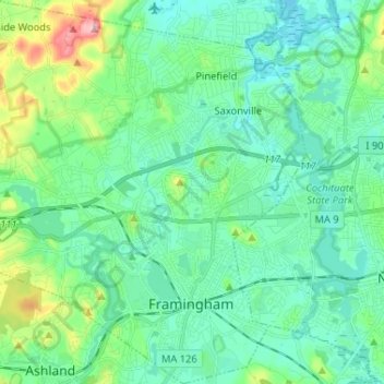
Name: Framingham topographic map, elevation, terrain.
Average elevation: 62 m
Minimum elevation: 31 m
Maximum elevation: 177 m
Other topographic maps
Click on a map to view its topography, its elevation and its terrain.
saxonville
United States of America > Massachusetts > Framingham > Saxonville
saxonville, Montage at Danforth Green, Saxonville, Framingham, Middlesex County, Massachusetts, 01705-0604, United States of America
Average elevation: 53 m