
Lough Derg topographic map
Interactive map
Click on the map to display elevation.
About this map
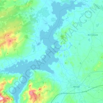
Name: Lough Derg topographic map, elevation, terrain.
Location: Lough Derg, County Tipperary, Munster, Ireland (52.82004 -8.50601 53.08449 -8.15746)
Average elevation: 87 m
Minimum elevation: 28 m
Maximum elevation: 529 m
County Tipperary trails, hiking, mountain biking, running and outdoor activities
Other topographic maps
Click on a map to view its topography, its elevation and its terrain.