
Williamstown topographic map
Interactive map
Click on the map to display elevation.
About this map
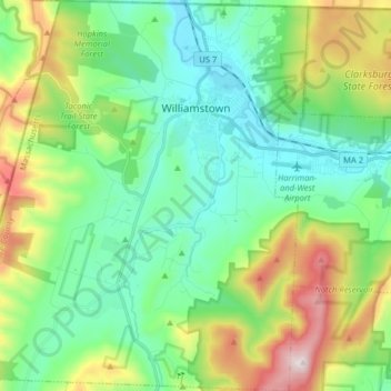
Name: Williamstown topographic map, elevation, terrain.
Average elevation: 424 m
Minimum elevation: 169 m
Maximum elevation: 1,061 m
Other topographic maps
Click on a map to view its topography, its elevation and its terrain.
Lanesborough
United States > Massachusetts > Berkshire County
Lanesborough, Berkshire County, Massachusetts, 01237, United States
Average elevation: 446 m