
Altar topographic map
Interactive map
Click on the map to display elevation.
About this map
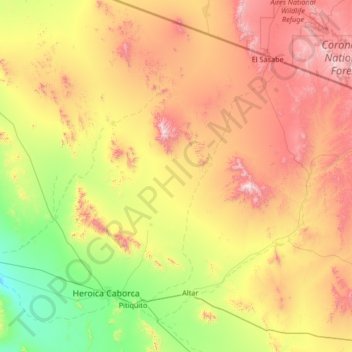
Name: Altar topographic map, elevation, terrain.
Location: Altar, Sonora, Mexico (30.52522 -112.29499 31.66461 -111.61246)
Average elevation: 686 m
Minimum elevation: 139 m
Maximum elevation: 1,645 m
Other topographic maps
Click on a map to view its topography, its elevation and its terrain.