
San Vito topographic map
Interactive map
Click on the map to display elevation.
About this map
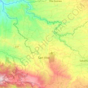
Name: San Vito topographic map, elevation, terrain.
Average elevation: 935 m
Minimum elevation: 405 m
Maximum elevation: 1,631 m
The city is located on a high plateau with very irregular topography, at an altitude of 996 metres (3,268 ft) above sea level in the foothills of the Talamanca Mountain Range. The narrow and fast-flowing Java River traverses the outskirts of San Vito from northeast to southeast.