
Rockingham County topographic map
Interactive map
Click on the map to display elevation.
About this map
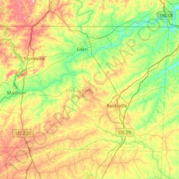
Name: Rockingham County topographic map, elevation, terrain.
Location: Rockingham County, North Carolina, United States of America (36.24142 -80.03512 36.54270 -79.51075)
Average elevation: 222 m
Minimum elevation: 132 m
Maximum elevation: 375 m
Other topographic maps
Click on a map to view its topography, its elevation and its terrain.