
East Hampshire topographic map
Interactive map
Click on the map to display elevation.
About this map
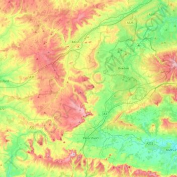
Name: East Hampshire topographic map, elevation, terrain.
Location: East Hampshire, Hampshire, South East, England, United Kingdom (50.94272 -1.13182 51.21274 -0.74470)
Average elevation: 122 m
Minimum elevation: 17 m
Maximum elevation: 269 m
Other topographic maps
Click on a map to view its topography, its elevation and its terrain.
Keeper's Hill
United Kingdom > England > East Hampshire
Keeper's Hill, East Hampshire, Hampshire, South East, England, GU30 7SA, United Kingdom
Average elevation: 89 m