
Kampung Damai topographic map
Interactive map
Click on the map to display elevation.
About this map
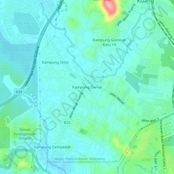
Name: Kampung Damai topographic map, elevation, terrain.
Location: Kampung Damai, Kuang, Selangor, 48050, Malaysia (3.21551 101.51972 3.25551 101.55972)
Average elevation: 43 m
Minimum elevation: 20 m
Maximum elevation: 148 m