
Laramie County topographic map
Interactive map
Click on the map to display elevation.
About this map
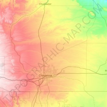
Name: Laramie County topographic map, elevation, terrain.
Location: Laramie County, Wyoming, United States of America (40.99807 -105.28067 41.65667 -104.05216)
Average elevation: 1,806 m
Minimum elevation: 1,304 m
Maximum elevation: 2,489 m
Other topographic maps
Click on a map to view its topography, its elevation and its terrain.
Cody
United States of America > Wyoming > Cody > Cody
Cody, Park County, Wyoming, United States of America
Average elevation: 1,557 m