
St Helier topographic map
Interactive map
Click on the map to display elevation.
About this map
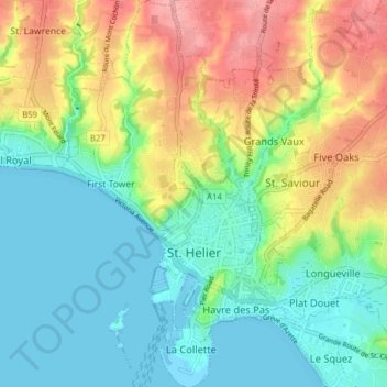
Name: St Helier topographic map, elevation, terrain.
Location: St Helier, Jersey (49.16785 -2.13694 49.21889 -2.08495)
Average elevation: 37 m
Minimum elevation: -2 m
Maximum elevation: 101 m