
Santarém topographic map
Interactive map
Click on the map to display elevation.
About this map
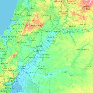
Name: Santarém topographic map, elevation, terrain.
Location: Santarém, Portugal (38.73149 -9.00157 39.83873 -7.80899)
Average elevation: 138 m
Minimum elevation: -2 m
Maximum elevation: 945 m
Other topographic maps
Click on a map to view its topography, its elevation and its terrain.