
Kapuas River topographic map
Interactive map
Click on the map to display elevation.
About this map
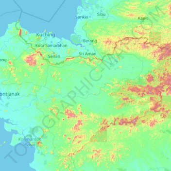
Name: Kapuas River topographic map, elevation, terrain.
Location: Kapuas River, West Kalimantan, 78611, Indonesia (-0.39897 109.08581 1.00329 113.63748)
Average elevation: 141 m
Minimum elevation: -4 m
Maximum elevation: 1,992 m
Other topographic maps
Click on a map to view its topography, its elevation and its terrain.
Tapang Pulau
Indonesia > West Kalimantan > Tapang Pulau
Tapang Pulau, Belitang Hilir, Sekadau, West Kalimantan, Indonesia
Average elevation: 24 m