
Auchinleck topographic map
Interactive map
Click on the map to display elevation.
About this map
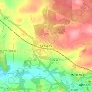
Name: Auchinleck topographic map, elevation, terrain.
Location: Auchinleck, East Ayrshire, Scotland, KA18 2DH, United Kingdom (55.45071 -4.31178 55.49071 -4.27178)
Average elevation: 149 m
Minimum elevation: 91 m
Maximum elevation: 202 m