
Britton Hill topographic map
Interactive map
Click on the map to display elevation.
About this map
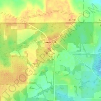
Name: Britton Hill topographic map, elevation, terrain.
Location: Britton Hill, Walton County, Florida, 32538, United States (30.98636 -86.28157 30.98646 -86.28147)
Average elevation: 93 m
Minimum elevation: 73 m
Maximum elevation: 109 m
Britton Hill is the highest natural point in the state of Florida, United States, with a summit elevation of 345 feet (105 meters) above mean sea level. Britton Hill is the lowest state highpoint in the United States, 103 feet (31 m) lower than the next lowest highpoint, Ebright Azimuth in Delaware, and far lower than many skyscrapers in Miami and other urban areas of Florida.
Other topographic maps
Click on a map to view its topography, its elevation and its terrain.
Freeport
United States > Florida > Walton County
Freeport, Walton County, Florida, 32439, United States
Average elevation: 14 m