
Khan Boeng Keng Kang topographic map
Interactive map
Click on the map to display elevation.
About this map
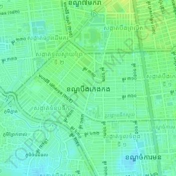
Name: Khan Boeng Keng Kang topographic map, elevation, terrain.
Location: Khan Boeng Keng Kang, Phnom Penh, Cambodia (11.54119 104.89845 11.55764 104.92905)
Average elevation: 13 m
Minimum elevation: 6 m
Maximum elevation: 21 m