
Cone Island topographic map
Interactive map
Click on the map to display elevation.
About this map
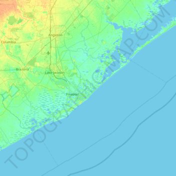
Name: Cone Island topographic map, elevation, terrain.
Location: Cone Island, Brazoria County, Texas, United States (28.65552 -95.61549 29.29552 -94.97549)
Average elevation: 3 m
Minimum elevation: -3 m
Maximum elevation: 19 m