
Doon topographic map
Interactive map
Click on the map to display elevation.
About this map
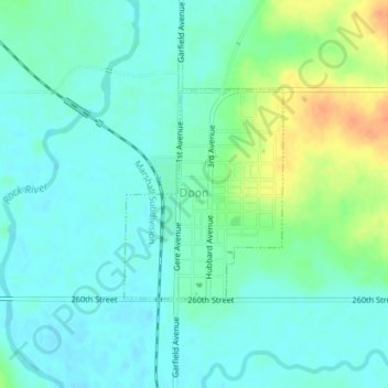
Name: Doon topographic map, elevation, terrain.
Location: Doon, Lyon County, Iowa, United States (43.27200 -96.24109 43.28659 -96.22587)
Average elevation: 394 m
Minimum elevation: 382 m
Maximum elevation: 423 m