
Laikipia County topographic map
Interactive map
Click on the map to display elevation.
About this map
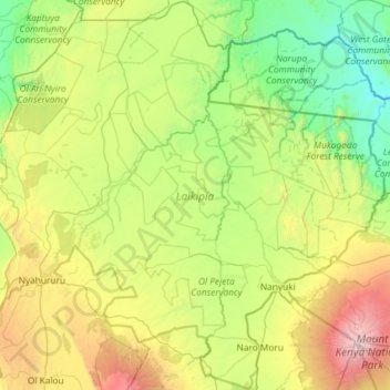
Name: Laikipia County topographic map, elevation, terrain.
Location: Laikipia County, Kenya (-0.29548 36.22669 0.86907 37.39570)
Average elevation: 1,936 m
Minimum elevation: 908 m
Maximum elevation: 5,086 m