
Dungarvan topographic map
Interactive map
Click on the map to display elevation.
About this map
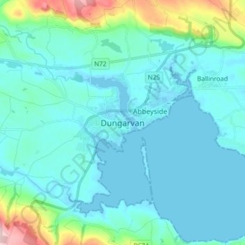
Name: Dungarvan topographic map, elevation, terrain.
Average elevation: 30 m
Minimum elevation: -2 m
Maximum elevation: 213 m
County Waterford trails, hiking, mountain biking, running and outdoor activities
Other topographic maps
Click on a map to view its topography, its elevation and its terrain.
Cheekpoint
Sleater's Topography of Ireland, published in 1806, has the following reference:- "Bolton, formerly called Cheekpoint, cotton factory and hoisery, established by Mr. Bolton. A most commodious Inn for passengers in the packets to and from Milford Haven in Pembrokershire." An earlier writer refers to it - "Mr.…
Average elevation: 25 m