
Grayson County topographic map
Interactive map
Click on the map to display elevation.
About this map
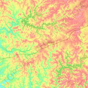
Name: Grayson County topographic map, elevation, terrain.
Location: Grayson County, Kentucky, USA (37.32081 -86.66849 37.62244 -86.01900)
Average elevation: 196 m
Minimum elevation: 121 m
Maximum elevation: 288 m
Other topographic maps
Click on a map to view its topography, its elevation and its terrain.
Georgetown
USA > Kentucky > Georgetown
Georgetown, Scott County, Kentucky, 40324, USA
Average elevation: 265 m