
Lithuania Park topographic map
Interactive map
Click on the map to display elevation.
About this map
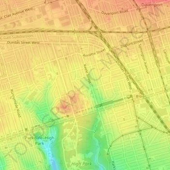
Name: Lithuania Park topographic map, elevation, terrain.
Average elevation: 114 m
Minimum elevation: 75 m
Maximum elevation: 134 m
Other topographic maps
Click on a map to view its topography, its elevation and its terrain.
Scarden Park
Scarden Park, Scarborough—Agincourt, Scarborough, Toronto, Golden Horseshoe, Ontario, Canada
Average elevation: 177 m
Toronto Islands
Toronto Islands, Old Toronto, Toronto, Ontario, M5J 2E9, Canada
Average elevation: 123 m