
Dunshaughlin topographic map
Interactive map
Click on the map to display elevation.
About this map
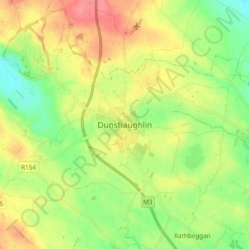
Name: Dunshaughlin topographic map, elevation, terrain.
Location: Dunshaughlin, County Meath, Leinster, A85 AE73, Ireland (53.47248 -6.57944 53.55248 -6.49944)
Average elevation: 99 m
Minimum elevation: 69 m
Maximum elevation: 137 m