
Creve Coeur topographic map
Interactive map
Click on the map to display elevation.
About this map
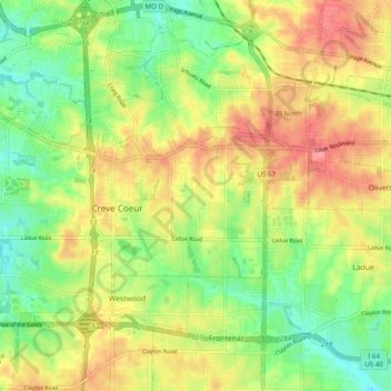
Name: Creve Coeur topographic map, elevation, terrain.
Average elevation: 184 m
Minimum elevation: 145 m
Maximum elevation: 226 m
Other topographic maps
Click on a map to view its topography, its elevation and its terrain.
Spanish Lake
United States > Missouri > Saint Louis County
Spanish Lake, Saint Louis County, Missouri, 63138, United States
Average elevation: 160 m