
Annagh topographic map
Interactive map
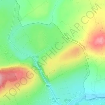
Click on the map to display elevation.
About this map
Name: Annagh topographic map, elevation, terrain.
Average elevation: 158 m
Minimum elevation: 97 m
Maximum elevation: 250 m
Ireland trails, hiking, mountain biking, running and outdoor activities
Other topographic maps
Click on a map to view its topography, its elevation and its terrain.
Barrington's Bridge
Ireland > The Municipal District of Cappamore — Kilmallock
Average elevation: 32 m
Galty Castle forest recreation area
Ireland > The Municipal District of Cappamore — Kilmallock
Average elevation: 233 m