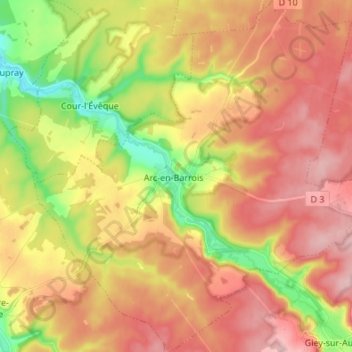
Arc-en-Barrois topographic map
Interactive map
Click on the map to display elevation.
About this map
Name: Arc-en-Barrois topographic map, elevation, terrain.
Average elevation: 340 m
Minimum elevation: 250 m
Maximum elevation: 410 m

Click on the map to display elevation.
Name: Arc-en-Barrois topographic map, elevation, terrain.
Average elevation: 340 m
Minimum elevation: 250 m
Maximum elevation: 410 m