
Norðoyar region topographic map
Interactive map
Click on the map to display elevation.
About this map
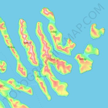
Name: Norðoyar region topographic map, elevation, terrain.
Location: Norðoyar region, Faroe Islands (62.16745 -6.81667 62.39430 -6.25363)
Average elevation: 90 m
Minimum elevation: -9 m
Maximum elevation: 834 m