

Monterrey topographic map
Click on the map to display elevation.
Monterrey
The city of Monterrey is 540 metres (1,770 ft) above sea level in the northeastern state of Nuevo León. Monterrey translated literally from Spanish to English is "King Mount" or "King Mountain", and folk etymology claims that this refers to the city's topography and the large mountains that surround it (actually, the city was named after the wife of Gaspar de Zúñiga, 5th Count of Monterrey). The Santa Catarina River—dry most of the year on the surface but with flowing underground water—bisects Monterrey from east to west, separating the city into north and south halves, and drains the city to the San Juan River and Rio Grande.
About this map
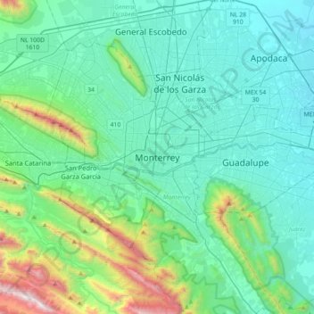
Name: Monterrey topographic map, elevation, terrain.
Location: Monterrey, Nuevo León, 64010, Mexico (25.52020 -100.47526 25.84020 -100.15526)
Average elevation: 753 m
Minimum elevation: 381 m
Maximum elevation: 2,521 m