
Meaux topographic map
Interactive map
Click on the map to display elevation.
About this map
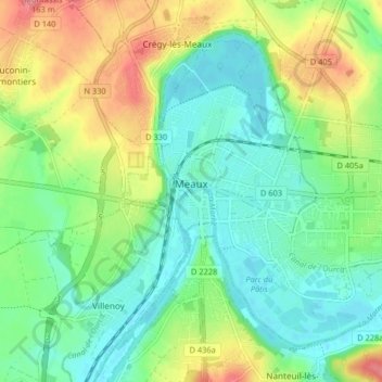
Name: Meaux topographic map, elevation, terrain.
Average elevation: 73 m
Minimum elevation: 43 m
Maximum elevation: 128 m
Other topographic maps
Click on a map to view its topography, its elevation and its terrain.
Avon
France > Ile-de-France > Seine-et-Marne
Avon, Fontainebleau, Seine-et-Marne, Ile-de-France, Metropolitan France, 77210, France
Average elevation: 88 m
Melun
France > Ile-de-France > Seine-et-Marne
Melun, Seine-et-Marne, Ile-de-France, Metropolitan France, 77000, France
Average elevation: 66 m