Geolocate

Tring topographic map

Click on the map to display elevation.

About this map

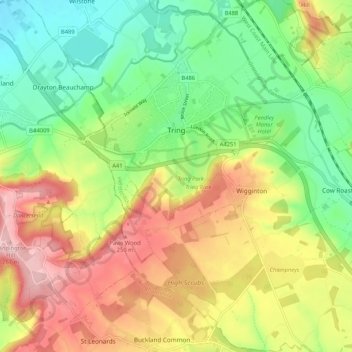
Name: Tring topographic map, elevation, terrain.

Location: Tring, Dacorum, Hertfordshire, England, United Kingdom (51.75304 -0.69022 51.81803 -0.62378)

Average elevation: 168 m

Minimum elevation: 87 m

Maximum elevation: 270 m

Other topographic maps

Click on a map to view its topography, its elevation and its terrain.

Gear up for your next adventure:

🧦Hiking Socks - Comfortable socks to prevent blisters
🪓Camping Axes & Hatchets - Wood cutting tools for campsite prep
🔦UV Flashlights - Search for minerals or inspect maps at night
🌄Sun Protection Gear - Gear to shield from strong sun
📡Satellite Messengers - Emergency communication for remote areas without signal

As an Amazon Associate, this site earns from qualifying purchases at no extra cost to you.