
Northville topographic map
Interactive map
Click on the map to display elevation.
About this map
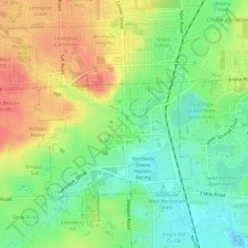
Name: Northville topographic map, elevation, terrain.
Location: Northville, Wayne County, Michigan, United States (42.42020 -83.51285 42.44490 -83.47213)
Average elevation: 258 m
Minimum elevation: 229 m
Maximum elevation: 292 m
Other topographic maps
Click on a map to view its topography, its elevation and its terrain.
Livonia
United States > Michigan > Wayne County > Livonia
Livonia, Wayne County, Michigan, United States
Average elevation: 201 m