
Thank you for supporting this site ❤️
Make a donation
Make a donation
Gear up for your next adventure:
As an Amazon Associate, this site earns from qualifying purchases at no extra cost to you.
Gauting topographic map
Click on the map to display elevation.
Thank you for supporting this site ❤️
Make a donation
Make a donation
Gear up for your next adventure:
As an Amazon Associate, this site earns from qualifying purchases at no extra cost to you.
About this map
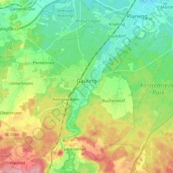
Name: Gauting topographic map, elevation, terrain.
Location: Gauting, Landkreis Starnberg, Bavaria, 82131, Germany (48.02768 11.27599 48.10133 11.42019)
Average elevation: 593 m
Minimum elevation: 541 m
Maximum elevation: 687 m
Thank you for supporting this site ❤️
Make a donation
Make a donation
Gear up for your next adventure:
As an Amazon Associate, this site earns from qualifying purchases at no extra cost to you.