

Saltillo topographic map
Click on the map to display elevation.
Saltillo
El Cerro del Pueblo (The Town Hill) and its 4-metre (13 ft) cross overlook the city. The city's elevation makes it colder and windier than the neighboring city of Monterrey. Saltillo lies in the Chihuahuan Desert near the city of Arteaga. The city is flanked by the Zapalinamé mountains, which are part of the Sierra Madre Oriental. According to local legend, by looking at the relief of the mountains one can see the relief of Zapalinamé, chieftain of the Guachichil tribe who rose against the Spaniards in 1584.
About this map
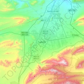
Name: Saltillo topographic map, elevation, terrain.
Location: Saltillo, Coahuila, 25000, Mexico (25.26304 -101.15275 25.58304 -100.83275)
Average elevation: 1,857 m
Minimum elevation: 1,319 m
Maximum elevation: 3,119 m