
Make a donation
Gear up for your next adventure:
As an Amazon Associate, this site earns from qualifying purchases at no extra cost to you.
Stübenwasen topographic map
Click on the map to display elevation.
Make a donation
Gear up for your next adventure:
As an Amazon Associate, this site earns from qualifying purchases at no extra cost to you.
Stübenwasen
Der Stübenwasengipfel ist nicht bewaldet. Die scharfen Übergänge zum Wald zeigen aber, dass es sich nicht um eine natürliche Waldgrenze handelt. Allein aufgrund der Höhe wäre der Stübenwasen nicht waldfrei, eine Waldgrenze wäre hier etwa 100 km nördlich der nächstgelegenen Nordalpengipfel etwa auf einer Höhe von 1.650–1700 m zu erwarten. Die Hochflächen werden im Sommer als Viehweide, im Winter als Skigebiet genutzt.
Make a donation
Gear up for your next adventure:
As an Amazon Associate, this site earns from qualifying purchases at no extra cost to you.
About this map
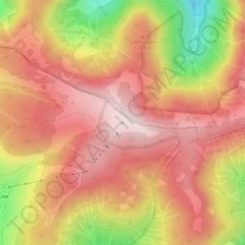
Name: Stübenwasen topographic map, elevation, terrain.
Average elevation: 1,222 m
Minimum elevation: 925 m
Maximum elevation: 1,388 m
Make a donation
Gear up for your next adventure:
As an Amazon Associate, this site earns from qualifying purchases at no extra cost to you.
Other topographic maps
Click on a map to view its topography, its elevation and its terrain.
Todtnauberg
Deutschland > Baden-Württemberg > Landkreis Lörrach > Todtnau
Der Todtnauberger Wasserfall ist mit 97 Metern Fallhöhe in fünf Fallstufen einer der höchsten Wasserfälle Deutschlands.
Average elevation: 1,117 m