
Wymondham topographic map
Click on the map to display elevation.
Wymondham
Wymondham's topography is marked by its river meadow and flat, low-lying agricultural landscape, much like the rest of East Anglia. The parish has an area of 17.11 square miles (44.31 km2). The geology is based on chalk, with a layer of boulder clay laid down in the last ice age. The River Tiffey, flowing north, forms a boundary between the built-up town centre and the rural southern part of the parish.
About this map
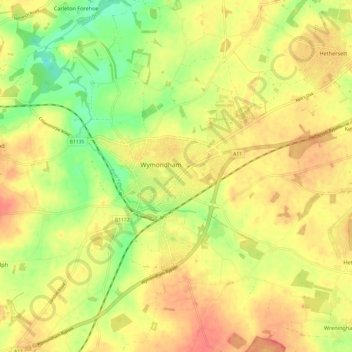
Name: Wymondham topographic map, elevation, terrain.
Location: Wymondham, South Norfolk, Norfolk, England, United Kingdom (52.53735 1.07661 52.61070 1.16459)
Average elevation: 43 m
Minimum elevation: 14 m
Maximum elevation: 65 m