Esher topographic map
Click on the map to display elevation.
Esher
Esher is an outlying suburb of London, close to the London–Surrey border; with Esher Commons at its southern end, the town marks one limit of the Greater London Built-Up Area. Esher has a linear commercial high street and is otherwise suburban in density, with varying elevations, few high rise buildings and very short sections of dual carriageway within the ward itself. Esher covers a large area, between 13 and 15.4 miles southwest of Charing Cross. In the south it is bounded by the A3 Portsmouth Road which is of urban motorway standard and buffered by the Esher Commons.
About this map
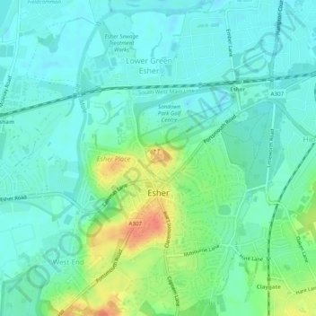
Name: Esher topographic map, elevation, terrain.
Location: Esher, Elmbridge, Surrey, England, United Kingdom (51.35752 -0.37844 51.38794 -0.35135)
Average elevation: 21 m
Minimum elevation: 8 m
Maximum elevation: 53 m
Other topographic maps
Click on a map to view its topography, its elevation and its terrain.