Geolocate

Cocoa topographic map

Click on the map to display elevation.

About this map

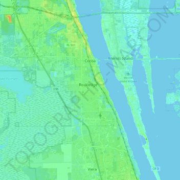
Name: Cocoa topographic map, elevation, terrain.

Location: Cocoa, Brevard County, Florida, United States (28.23185 -80.82081 28.41841 -80.72107)

Average elevation: 5 m

Minimum elevation: -2 m

Maximum elevation: 30 m

Gear up for your next adventure:

🎒Surveyor High-Vis Vests - Multi-pocket safety vests for field professionals
🚴Mountain Bikes - Bikes for off‑road trails and terrain
🌲Survival Gear - Equipment for outdoor survival situations
💡Hiking Headlamps - Hands‑free lights for night hikes
🍖High-Protein Trail Snacks - Lightweight fuel for long distance treks

As an Amazon Associate, this site earns from qualifying purchases at no extra cost to you.