
Thank you for supporting this site ❤️
Make a donation
Make a donation
Gear up for your next adventure:
As an Amazon Associate, this site earns from qualifying purchases at no extra cost to you.
Iden topographic map
Click on the map to display elevation.
Thank you for supporting this site ❤️
Make a donation
Make a donation
Gear up for your next adventure:
As an Amazon Associate, this site earns from qualifying purchases at no extra cost to you.
About this map
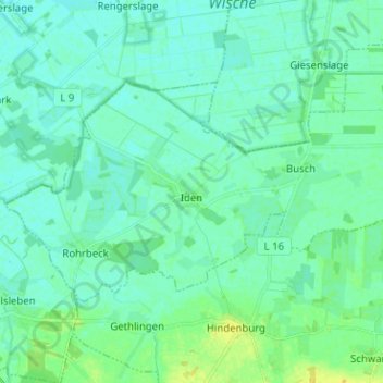
Name: Iden topographic map, elevation, terrain.
Location: Iden, Arneburg-Goldbeck, Stendal, Saxony-Anhalt, Germany (52.75860 11.85276 52.80276 11.97916)
Average elevation: 26 m
Minimum elevation: 21 m
Maximum elevation: 41 m
Thank you for supporting this site ❤️
Make a donation
Make a donation
Gear up for your next adventure:
As an Amazon Associate, this site earns from qualifying purchases at no extra cost to you.