
Thank you for supporting this site ❤️
Make a donation
Make a donation
Gear up for your next adventure:
As an Amazon Associate, this site earns from qualifying purchases at no extra cost to you.
Bampton topographic map
Click on the map to display elevation.
Thank you for supporting this site ❤️
Make a donation
Make a donation
Gear up for your next adventure:
As an Amazon Associate, this site earns from qualifying purchases at no extra cost to you.
About this map
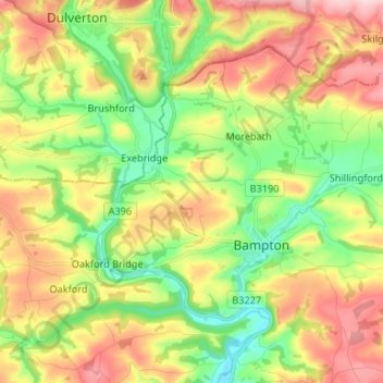
Name: Bampton topographic map, elevation, terrain.
Location: Bampton, Morebath, Mid Devon, Devon, England, United Kingdom (50.97307 -3.54310 51.03148 -3.41106)
Average elevation: 185 m
Minimum elevation: 82 m
Maximum elevation: 315 m
Thank you for supporting this site ❤️
Make a donation
Make a donation
Gear up for your next adventure:
As an Amazon Associate, this site earns from qualifying purchases at no extra cost to you.