Geolocate

Clitheroe topographic map

Click on the map to display elevation.

About this map

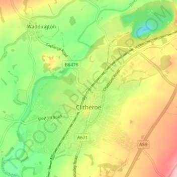
Name: Clitheroe topographic map, elevation, terrain.

Location: Clitheroe, Ribble Valley, Lancashire, England, United Kingdom (53.85666 -2.42473 53.89501 -2.35846)

Average elevation: 84 m

Minimum elevation: 13 m

Maximum elevation: 167 m

Other topographic maps

Click on a map to view its topography, its elevation and its terrain.

Gear up for your next adventure:

🥾Men's Waterproof Boots - Sturdy footwear for wet and boggy Irish terrain
🫗Collapsible Water Bottles - Space‑saving hydration
📱Phone Holders for Biking - Secure phone mounts for touring cyclists
Emergency Bivvy Bags - Life-saving heat-reflective shelter for emergencies
🧊Winter Boot Traction - Grip for icy paths in the Mourne or Derryveagh mountains

As an Amazon Associate, this site earns from qualifying purchases at no extra cost to you.