Geolocate

Middlewich topographic map

Click on the map to display elevation.

About this map

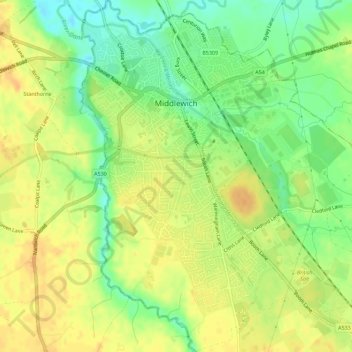
Name: Middlewich topographic map, elevation, terrain.

Location: Middlewich, Cheshire East, England, United Kingdom (53.16879 -2.46091 53.20262 -2.40556)

Average elevation: 40 m

Minimum elevation: 21 m

Maximum elevation: 53 m

Gear up for your next adventure:

🕶️Polarized Sunglasses - Reduce glare from lakes and sea cliffs
🍖High-Protein Trail Snacks - Lightweight fuel for long distance treks
📱Rugged Smartphones - Waterproof phones with long battery for offline mapping
🍴Camp Kitchen Kits - Lightweight nesting pots and pans for backpacking
🧥Waterproof Hiking Jackets - Rain jackets for unpredictable weather

As an Amazon Associate, this site earns from qualifying purchases at no extra cost to you.